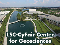
LSC-CyFair Center for Geosciences

The LSC-CyFair Center for Geosciences promotes faculty collaboration across multiple disciplines to offer students unique educational opportunities through shared resources such as the Remote Sensing and Unmanned Aerial Systems (UAS). Students will also benefit through practical application of emergent geospatial technologies and improved pathways to transfer programs as well as career-oriented certificates and degrees. Students may concentrate on programs which transfer to 4-year institutions in Geography, Geographic Information Systems Technology, Anthropology, Geology, Environmental Sciences or Meteorology or choose a shorter path to a good career with workforce certificates and degrees in Petroleum Data Technology or Geographical Information Systems.
LSC-CyFair has unique program offerings and faculty expertise in Geography, Anthropology/Archaeology, GIS and Petroleum Data Technology which creates a unique environment within the Lone Star College. This combined expertise in one location as well as connections to industry, archaeology research and community visibility provides students with the opportunity to learn in state of the art lab facilities using real world examples they will encounter in Geoscience related career fields.
Requests for community projects requiring the use of Unmanned Aerial Systems should be directed to Professor Buck Buchanan at Buck.J.Buchanan@lonestar.edu.
Related
Transfer Programs
Texas A&M
UH Downtown